There's a lane in North Tipperary that turns amber and rust in October, flanked by old beech trees so dense they form a tunnel. No tourist board sign. No lay-by with an information board. Just road, colour, and the sound of your tyres on wet tarmac.
Google Maps will route you around it every time.
The irony is that the same autonomous shuttle technology creeping across European logistics hubs, the kind we've been watching map and measure every inch of infrastructure, is slowly pulling these forgotten roads into the digital light. Survey vehicles. LIDAR sweeps. Camera rigs on every verge. The algorithms are coming. But they're not here yet. Which means you still have a window.
Here's where to point the car before the software catches up.
The Comeragh Mountain Loop, County Waterford
Most people drive through Waterford on the way to somewhere else. That's their loss.
The R676 from Carrick-on-Suir up into the Comeraghs is a proper driver's road. It climbs hard, narrows without warning, and rewards you with views across the Nire Valley that feel genuinely earned. At this time of year the bracken goes copper-red and the whole hillside looks like it's been lit from underneath.
Come down via Mahon Falls and loop back through Ballymacarbry. The whole run is about 65km. It takes longer than it should, because you'll stop. Bring something warm.
The Glendine Gap, Offaly to Tipperary
People drive the N52 all the time and don't even know this road exists six kilometres to the west.
The Glendine Gap cuts through the Slieve Bloom Mountains between Kinnitty and Cloughjordan. It's classified. It's paved. It is, in every practical sense, a real road. GPS still treats it like a rumour. The surface is fine for a standard hatchback, though a 2015 Ford Focus with 140,000km on it might bounce through the rougher patches near the summit.
The views from the top on a clear autumn day stretch into four counties. You'll have them entirely to yourself on a Tuesday in October.
The Inishowen Loop, County Donegal
Donegal gets attention. The Wild Atlantic Way has sorted that. But the Inishowen Peninsula, tucked up in the very top-right of the country, stays quiet long after the summer traffic has cleared out.
Start in Buncrana. Take the coast road north through Dunree, past the old military fort and down toward Mamore Gap. The gap itself is a steep, tight climb that will make any passenger nervous and any driver grin. Malin Head beyond it is the northernmost point in Ireland, frequently windy, always worth it.
Loop back through Carndonagh and you've done a circuit of about 130km. It's genuinely one of the best driving roads in Ireland that tourism campaigns chronically undersell.
The Monsal of the Midlands: The Grand Canal Way, Offaly
Not a mountain road. Not a cliff. Just flat, wide sky, still water, and almost no traffic.
The R436 running alongside the Grand Canal from Tullamore toward Banagher is the kind of drive that people from the west and east both overlook because they've been told the Midlands are boring. They're wrong. In autumn fog this stretch has an atmosphere that'll stick with you.
Pull into Banagher for lunch. It's a proper little river town with a few good spots on the main street. Then head south along the Shannon if you want to extend the day.
The Beara Way, Cork and Kerry
The Ring of Kerry gets the coaches. Beara gets the people who've been to Kerry before and know better.
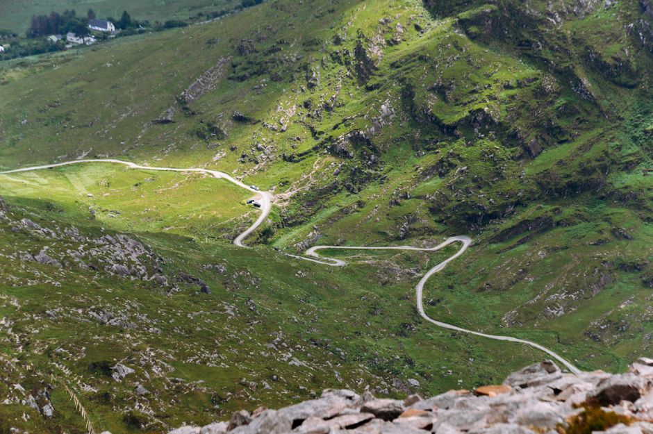
The R571 from Kenmare around the Beara Peninsula through Ardgroom and Eyeries is twistier, quieter, and frankly more dramatic than its famous neighbour. The Healy Pass sits in the middle of it all, a serious piece of road engineering that cuts between Cork and Kerry via a climb that'll have your ears popping.
The villages are small. The pubs are real. The 3G signal disappears for stretches, which is either a problem or the whole point, depending on who you are.
Practical Notes Before You Go
Check your spare tyre before any of these runs. A slow puncture on the Glendine Gap is not an experience you want. Some of these roads are far enough from mobile coverage that roadside assistance response times stretch considerably.
Fuel up before you go into the hills. Not all of these areas have petrol stations at convenient intervals. The Beara Peninsula in particular can catch people short.
And take a paper map or download offline maps before you leave. The whole premise of this article is that these routes are imperfectly served by GPS. There are real risks in over-relying on your sat-nav on roads it barely knows exist.
The Window Is Closing
The survey vehicles will get there eventually. LIDAR doesn't take days off. In two or three years, the algorithm will know about the Glendine Gap and the beech tunnel in Tipperary, and it'll route the school run traffic straight through both of them.
For now, that lane in North Tipperary is still amber and rust in October, still unknown to anything with a processor, still exactly the kind of road that reminds you why you drive in the first place.
Go before the software finds it.