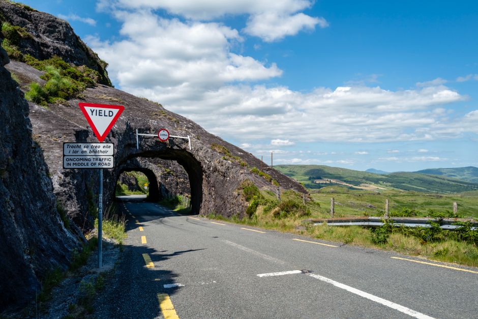
There are roughly four million people in this country and most of them, given a sunny weekend, apparently decide to drive the Ring of Kerry at the same time. Meanwhile, about 200 kilometres east, the Copper Coast sits largely empty, the road peeling along the cliff edge between Dunmore East and Tramore, with nobody in front of you and nobody behind.
That's the trick with Waterford. It doesn't shout. It doesn't have a marketing budget like Kerry or a celebrity endorsement like the Wild Atlantic Way. What it has is better roads, real villages, a mountain range that actually delivers on a clear day, and the kind of driving that reminds you why you bothered getting a car in the first place. This loop covers roughly 130 kilometres. You can do it in three hours if you're in a rush, but you'd be doing it wrong.
Start in Dunmore East: Don't Skip Breakfast
Dunmore East is a proper fishing village, the kind with working boats alongside the tourist ones and a chipper that doesn't apologise for existing. Park near the harbour and get food before you leave. The road out is too good to be thinking about lunch.
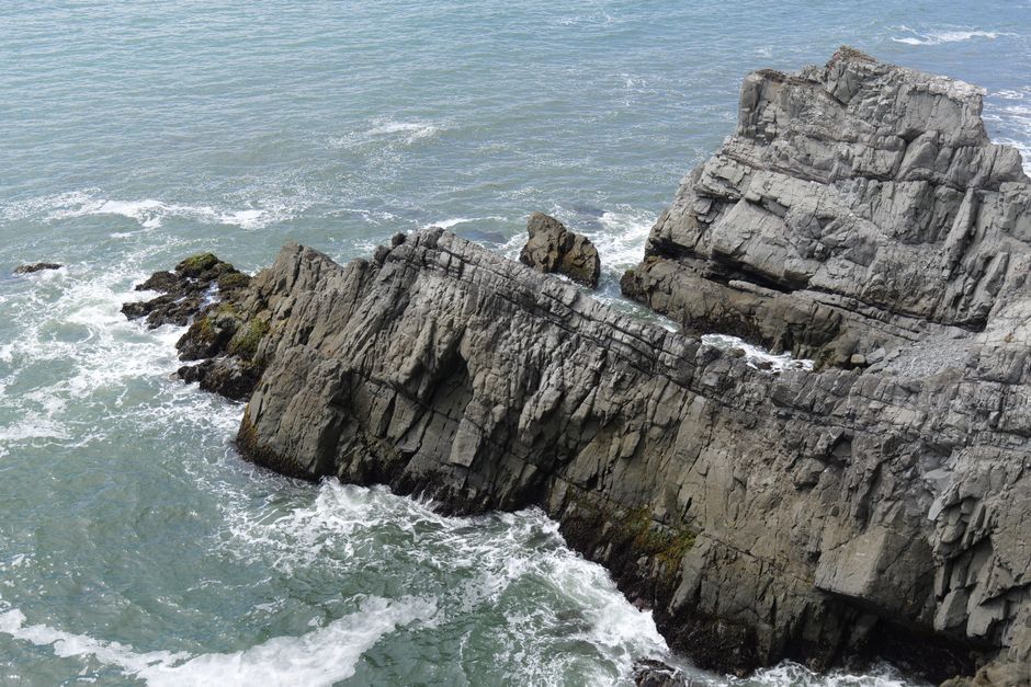
Leave the village heading west on the R684. Within two kilometres you're on cliff-top road with the Celtic Sea below you and nothing between you and the horizon. The surface here is decent. The bends are tight enough to be interesting but not the terrifying single-track variety that eats wing mirrors. This stretch rewards patience. Don't rush it. You'll want to pull over at Swine Head, which has a layby and a view that earns its own category.
Tramore: Stop, Walk, Then Leave
Tramore is 18 kilometres from Dunmore East and it's where the loop could easily fall apart if you let it. The town is fine. The beach is big. The amusements are loud. Spend twenty minutes walking the prom, get a coffee, and then get back in the car before Tramore does its thing and absorbs an entire afternoon.
Head west out of town on the R675. This is where the Copper Coast Geopark officially begins, and the road earns the name. The cliffs here show copper-coloured rock formations left over from ancient volcanic activity, and the light on a clear day turns everything a shade of orange that looks slightly unreal. Annestown, Bunmahon, Stradbally, Ballyvooney. Each village smaller than the last. Each one with enough of a layby or a beach access point to justify stopping if something catches your eye.
Bunmahon is worth ten minutes. It has a small beach sheltered by headlands, a car park that's usually not full, and the ruins of copper mining infrastructure visible along the coast path. The Copper Coast wasn't named for the colour. It was named for the industry that ran here from the 1820s, with Cornish miners imported to work seams that employed thousands at peak operation. The cliffs remember all of it.
Dungarvan: The Natural Midpoint
About 50 kilometres from your starting point, Dungarvan appears around a wide estuary bend and it's a proper reward. Park near the town square. Stretch. Eat something. Dungarvan has better food options than its size suggests, partly because it sits at the crossroads of enough tourist traffic to support decent restaurants without being overwhelmed by them.
The town is also where you pick up the N25 briefly before turning north onto the R672. This is the pivot point of the loop, where the route stops being coastal and starts climbing.
The Comeragh Mountains: Where the Drive Earns Its Reputation
The R672 north from Dungarvan rises into the Comeragh Mountains through Lemybrien and toward Carrick-on-Suir, and this is the section most guides forget to mention. The Comeraghs aren't dramatic in a Connemara way. They're moorland, glacial lakes, long ridgelines, and a quality of silence that feels almost deliberate.
The road climbs to around 300 metres at its highest point. In clear weather, you can see back across the whole Waterford coastline, out toward the Hook Peninsula, and on exceptional days across to Wexford. In low cloud, the whole thing becomes a different drive entirely, moody and close, the kind of road that makes you feel like you're the only person left.
The surface on this stretch varies. Some sections are excellent. One or two have the texture of a gravel driveway that someone tarmacked in a hurry in 2003 and hasn't looked at since. Nothing dangerous, but worth knowing if you're driving a low-slung car. A standard hatchback handles it fine. A 2015 Skoda Octavia with reasonable ground clearance will have no complaints at all.
Watch for cyclists on the descent into Carrick-on-Suir. The road is wide enough but the gradient brings cyclists down at speed and they appear in corners without warning.
Carrick-on-Suir to the Close
Carrick-on-Suir sits on the Tipperary border and it's genuinely underrated as a stop. Ormond Castle, the last unfortified Tudor manor house in Ireland, sits in the town centre and takes about 45 minutes if you have any interest in history whatsoever. The town itself has a river walk along the Suir that's worth ten minutes of your legs.
From Carrick, the R680 runs southeast back toward Waterford city along the river valley. The road here is fast and open, following the Suir through flood meadows and past old estate walls. It's the motorway stretch of a route that hasn't had a motorway in it. Not exciting exactly, but satisfying in the way that a well-paced final chapter is satisfying.
You can extend the loop by cutting south toward Kilmacthomas and rejoining the coast at Bonmahon for a second look, or push directly into Waterford city if you need a proper dinner and somewhere to leave the car. The city is 25 kilometres from Carrick on the N24 and you'll be back before dark if you left Dunmore East by ten in the morning.
What Car to Bring
Any car that runs. Genuinely. This isn't a road trip to Scotland from Dublin requiring ferry logistics and contingency planning. It's 130 kilometres of mostly good tarmac with one rougher mountain section. If you're planning a longer trip and thinking about Ireland's best driving roads more broadly, this loop belongs on that list and usually gets left off.
A word on fuel: fill up in Dungarvan or Carrick-on-Suir. The villages on the Copper Coast itself are scenic but not especially well-stocked with petrol stations. Running into Bunmahon with 20 kilometres of range left is not a crisis, but it's a mild inconvenience that you can avoid with five minutes of planning.
The One Thing Worth Knowing
The Copper Coast Geopark is a UNESCO-designated area, which sounds like the kind of information that belongs in a press release. What it means in practice is that the landscape has genuine protected status and the roads through it are unlikely to ever be widened or improved in a way that ruins them. What you're driving now is what it'll be in twenty years. That's rarer than it sounds in this country.
Dunmore East is still there when you get back, same as you left it, the boats out on the water, the cliff path empty. Most people are still stuck somewhere between Killarney and Kenmare, wondering if the sat nav is broken.