Pull over anywhere on the Healy Pass and count the vehicles. On a bright July Saturday, you might see four. Maybe six. Compare that to the Ring of Kerry on the same day, where the N70 turns into a slow-motion parade of tour coaches, rental Qashqais, and cyclists making optimistic life choices. Beara doesn't advertise itself. That's the whole point.
The Beara Peninsula stretches roughly 48 kilometres into the Atlantic between County Cork and County Kerry, a spine of the Caha and Slieve Miskish mountain ranges with the Kenmare River to the north and Bantry Bay to the south. It's the same wild southwest corner that gets the same battering Atlantic weather, the same light that makes photographers cry, the same impossibly green everything. It just hasn't been packaged yet. And the roads are genuinely interesting to drive, which matters if you're here in a car rather than a seat on a bus.
The Ring of Kerry is a fine thing. But it's also 179 kilometres of road that now functions more as a managed tourist experience than a drive. You'll find it without the tour buses if you go early enough or in the wrong season, but it takes effort. Beara requires no such strategy. It's just quieter, by default.
Where to Start
Glengarriff is the obvious entry point from the east, sitting at the head of Bantry Bay with its subtropical gardens on Garnish Island and a ferry queue that moves with unhurried Cork logic. From here you pick up the R572 and start heading west along the southern shore toward Castletownbere. This stretch is your warm-up. The road curves along the water, forested hills to one side, the bay spreading out to the other. You'll average maybe 50km/h if you're honest about it. That's not a complaint.
Castletownbere is the main town and the largest whitefish port in Ireland. It's a working place, not a heritage experience. There are trawlers, there's a SuperValu, and there's a pub called MacCarthy's that has a coffin shop attached. Ireland doesn't do irony on purpose but it does it well. Stop here, fill the tank, get coffee that tastes like coffee.
The Healy Pass
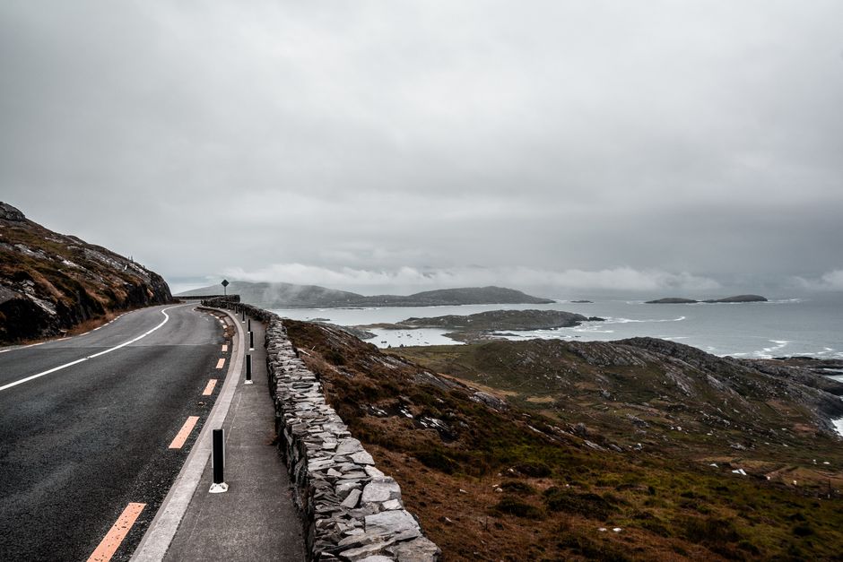
This is what you came for. The R574 climbs from Adrigole on the south coast up to the Cork-Kerry county border and drops down into Lauragh on the north side. It's 10 kilometres of proper mountain road: tight, exposed, and visually ridiculous in the best possible way. At the top, on a clear day, you can see Kenmare Bay, the Iveragh Peninsula beyond it, and a lot of empty sky. On a bad day you're in cloud and the whole thing becomes something else entirely. Both versions are worth it.
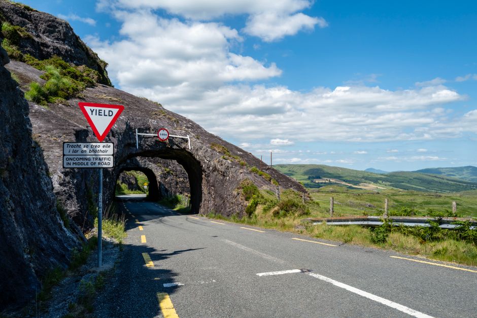
The road is narrow. Two cars can pass in most places but you'll be doing a lot of that Irish driving diplomacy, the slight slow-down, the read of the other driver, the mutual nod of appreciation. No aggression, no stress. It's one of Ireland's best driving roads in miniature.
If you want to know more about the Healy Pass specifically, there's a dedicated piece on it here that goes into the detail.
The North Shore Back
Once you descend into Lauragh on the Kerry side, you pick up the R571 heading back east along the northern shore of the peninsula, with the Kenmare River on your left. This road is gentler than the south, more sheltered, greener. You'll pass through Ardgroom and Eyeries, the latter known for being painted in shades that look like a film set but are entirely real. Each house its own colour. It's the kind of village that makes you wonder why everywhere doesn't just do that.
The road continues through Allihies, which sits on the westernmost tip of the peninsula near old copper mine workings that you can walk around if your legs are willing. The views from here out to the Mizen and Sheep's Head peninsulas to the south are on the better end of what this country offers. That's saying something.
Practical Notes
The full loop from Glengarriff, west along the south shore, over the Healy Pass, east along the north shore, and back via the Kenmare road runs somewhere between 130 and 150 kilometres depending on your detours. Allow a full day. This is not a route to rush.
Fuel: fill up in Castletownbere. Options get sparse on the western end of the peninsula.
Roads: narrow throughout, particularly on the west. An SUV or large estate is manageable but anything wider than a Transit van will be having conversations with hedges. A regular family hatchback is ideal. Ground clearance is not an issue on the main roads.
Season: July and August are the busy months on the peninsula, though "busy" is relative. September and October are genuinely spectacular, with better light and virtually no traffic. The autumn road trip guide covers why October specifically is worth planning around.
Accommodation: Castletownbere and Allihies both have options. Glengarriff has more. Booking in peak summer is wise. Outside peak, you'll be grand showing up.
What You Won't Get
No cable cars. No designated photo stops with coaches parked three deep. No audio guide piped through a speaker on a seat in front of you. No one selling you a laminated postcard of somewhere you're currently standing.
What you will get is the actual southwest: the kind of driving that asks something small of you and returns something large. The road through the Healy Pass doesn't care if you've seen a mountain pass before. It'll show you one anyway.
The Ring of Kerry gets the postcards. Beara gets the drivers who figured out there was a better option a peninsula south.